
Altitude and location
See your altitude, coordinates and GPS accuracy at a glance.
Wildlife · Summits · Hiking
Picchu helps you recognize animals, understand what lives nearby and read the terrain more clearly while you are out.
Made for iPhone and iPad. Useful outdoors, even when the signal fades.
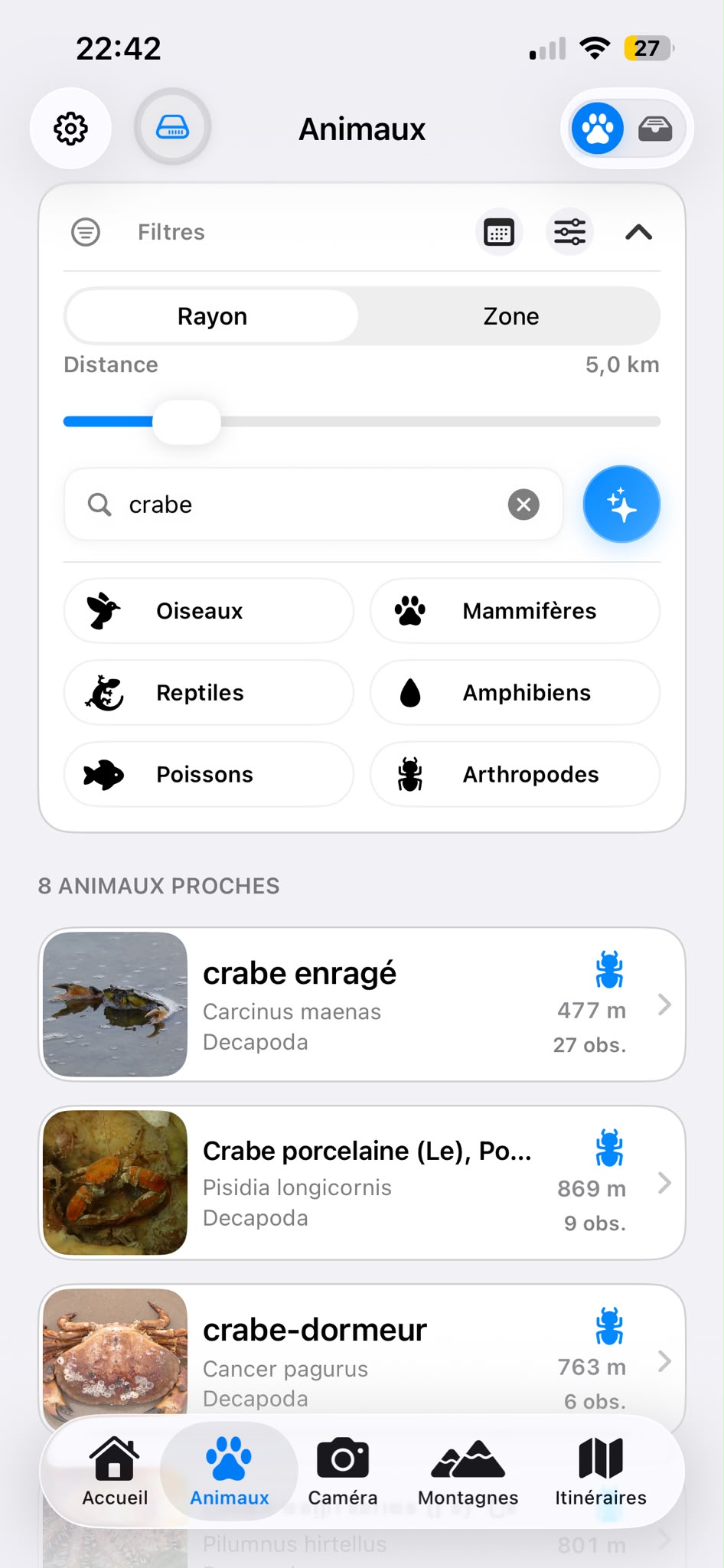
Wildlife around you
Search for species found near your location, explore their profiles and view their distribution. Country data can be prepared before you leave.
Explore animals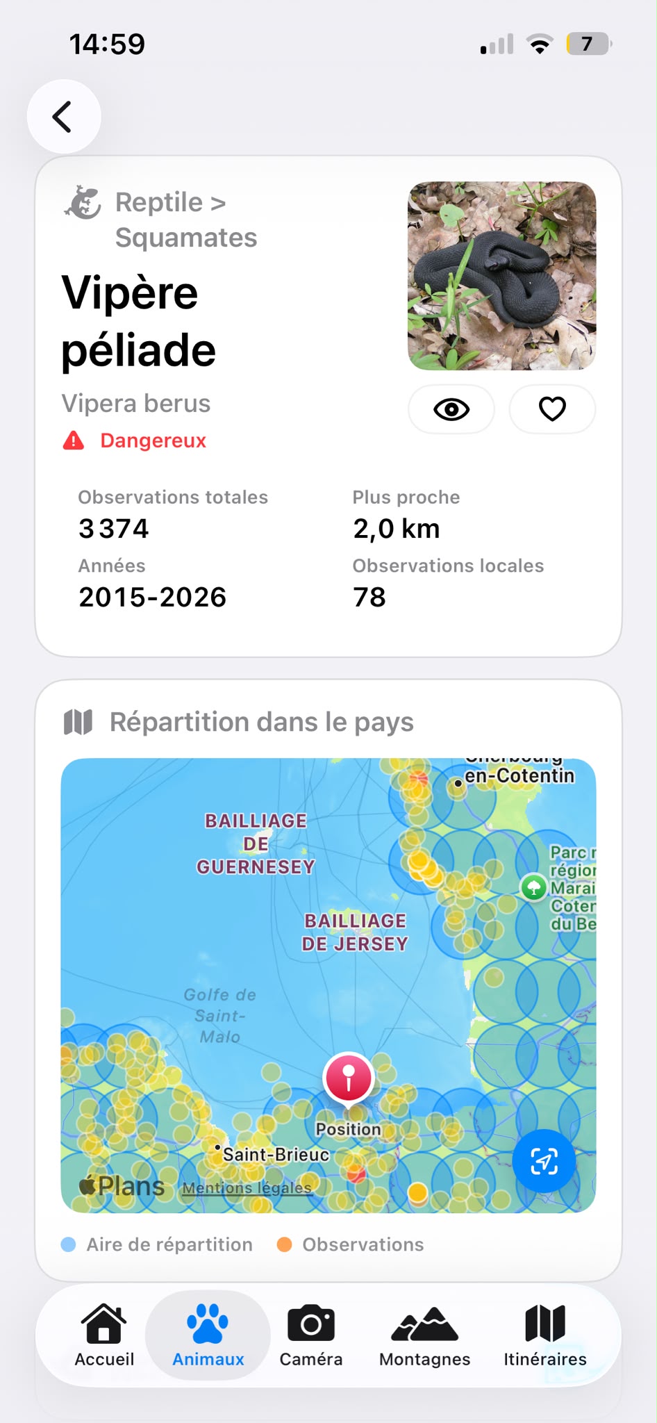
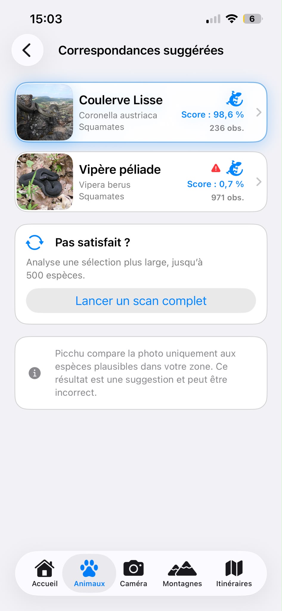
AI-assisted identification
Take a photo or choose one from your library. Picchu compares it with relevant species and suggests matches for you to check in their profiles.
Along the way
Picchu brings useful outdoor information together in a calm, readable interface.
See your altitude, coordinates and GPS accuracy at a glance.
Search surrounding peaks and locate them through the camera preview.
Record a route or import GPX, KML and KMZ files.
Plan with dawn, sunrise and sunset times.
Built for the outdoors
Location and camera access are requested only when a feature needs them. Picchu favours local storage, lets you clear your history and does not collect data for advertising.
Learn moreDiscover wildlife, observe the summits and keep the useful details of your outing in one place.